


Finding my routes


Above is a map of US counties where I have taken photographs. What that means is that these are places where I took a photo that I edited a little, and then shared with friends on Facebook. Here’s one of the first that I posted.
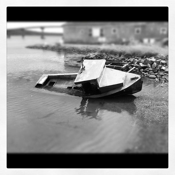
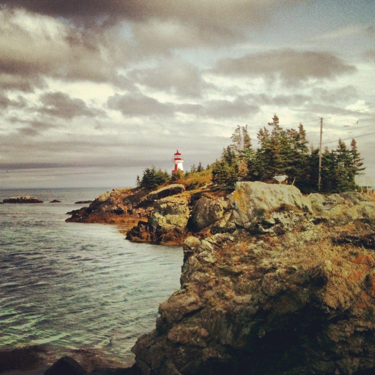
In that case, I decided to drive as far down-east as I could go in Maine, winding up in Lubec. It’s in Washington County, and it’s also the easternmost point in the US. I’m not counting the silliness that there is an island in Alaska that is over the international dateline; this is the easternmost point. I took a picture of the famous lighthouse, but I like better the one that I saw on Campobello Island (Canada)
These pictures were from 2011. The attractive thing about Washington County is that the oppressive Maine tourism pretty much ends after Acadia. I stayed in a nice but not overly luxe guesthouse. This was before the era of Airbnb, and let’s just say the host had a certain character that you could only find in coastal Maine. Once a colleague told me that her Maine mom was told about a friend who found out that she had cancer: “Listen de-ah, everyone has canc-ah, it’s just waitin’ to break out.” That’s a very Maine thing to say.
Since then I have taken photos in 169 counties.
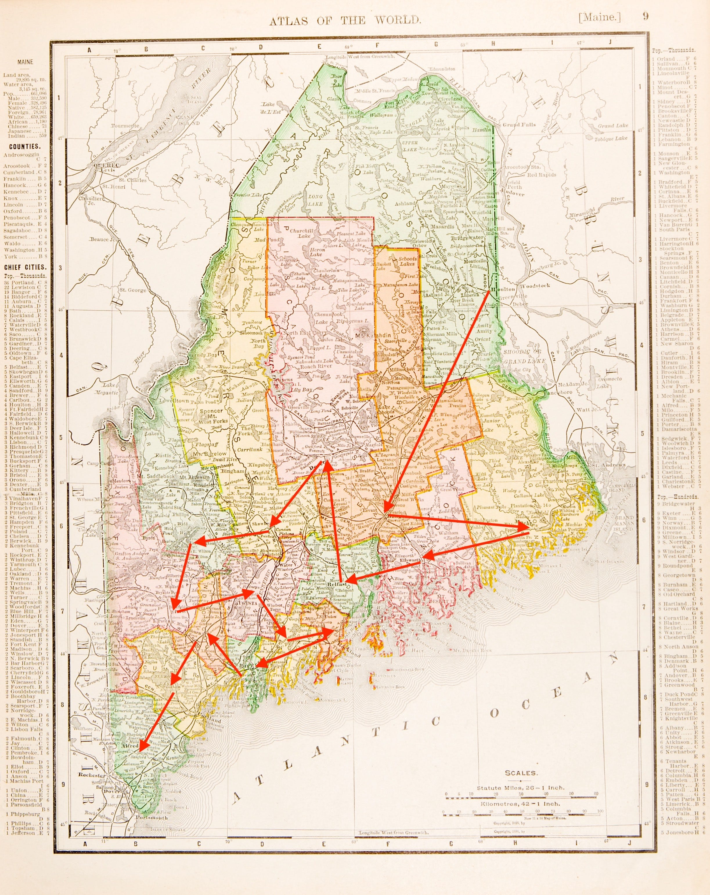
Driving to counties, when you want to add to a life list, takes some planning. If you want to plan an effective route that includes each Maine county, for instance, I propose the route shown below. Keeping in mind that the whole northern half is basically a single forest, there is still a certain amount of zigzagging you have to do.. I’ve done most of them, but not Aroostook (think Maine potatoes), nor Oxford (White Mountains) yet.
When visiting new counties, the problem is, you tend to run out of them nearby. I’ve put 350,000 miles on two Jeeps, and still only covered 5% of the total counties that I could visit. What are the chances that I could get to all? I did 169 in 10 years, so at that rate I couldn’t cover the total in 100 years. Actually, I haven’t even done all the Indiana counties. I’ve totally covered the bottom half, but have done less well with the boring northern ones.
I probably should have known this earlier, but there are other people who “collect” counties. There is something called the “Extra Miler Club,” with multiple people who have visited every county. From the looks of the members, it seems like being retired is a prerequisite for getting to all the counties within a reasonable span (10-20 years).
I requested AI to make me a map, similar to the one I made of Maine, of how you could get to every US county. That turned up the Traveling Salesman Problem, which is a problem needing big computers and math wonks. The problem for all US counties seems like it might unsolvable. A map of it is unreadable. Below is a simple version of how you would do it for the lower 48 states.

Planning a route algorithmically does take some fun out of the process. Many times I preferred to head out to just make some random turns and see where I ended up. The problem is, several years later on a new trip I found that I ended up making the same “random” turns and wound up in the same place. An era of self-driving Jeeps might solve this problem, where one could just program in unvisited spots…
Here’s a few counties to give a flavor… Still only 5% of the way there…
Madison County, Ohio
Normally I stop there for gas when driving from Indiana to Connecticut. The county seat is London. On a nice day one gets off the interstate… I was told by a colleague that a major decision that Dorothea Lange would make, when taking pictures of the Depression, was whether it was worth it visually to get out of the car.
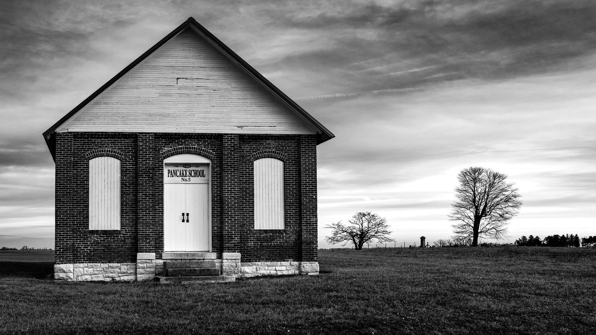
One room schoolhouses are something I will stop for. The “Pancake” School is reportedly haunted by children killed by Indians. It doesn’t really make sense to me, because some other reports say the school was built as late as the early 1900s. Some ghost hunters reported some eerie sounds from here. More data are needed.
Hancock County, Illinois
One day I decided to do an overnight trip. I drove all the way to Mississippi River. Arriving at the river, you really start to feel like you’re getting out of town. I thought I would visit Hannibal, MO and see Mark Twain things. Before I got there, though, I hit Nauvoo, Illinois. It was one of the stops that the Mormons made on their westward journey to paradise. There’s now a sparkling new temple there on a hill, and down by the river is a recreation of the original Mormon village. Joseph Smith went from there back to Carthage and got murdered by a mob. His brother too. The statue shows them riding back toward their martyrdom.
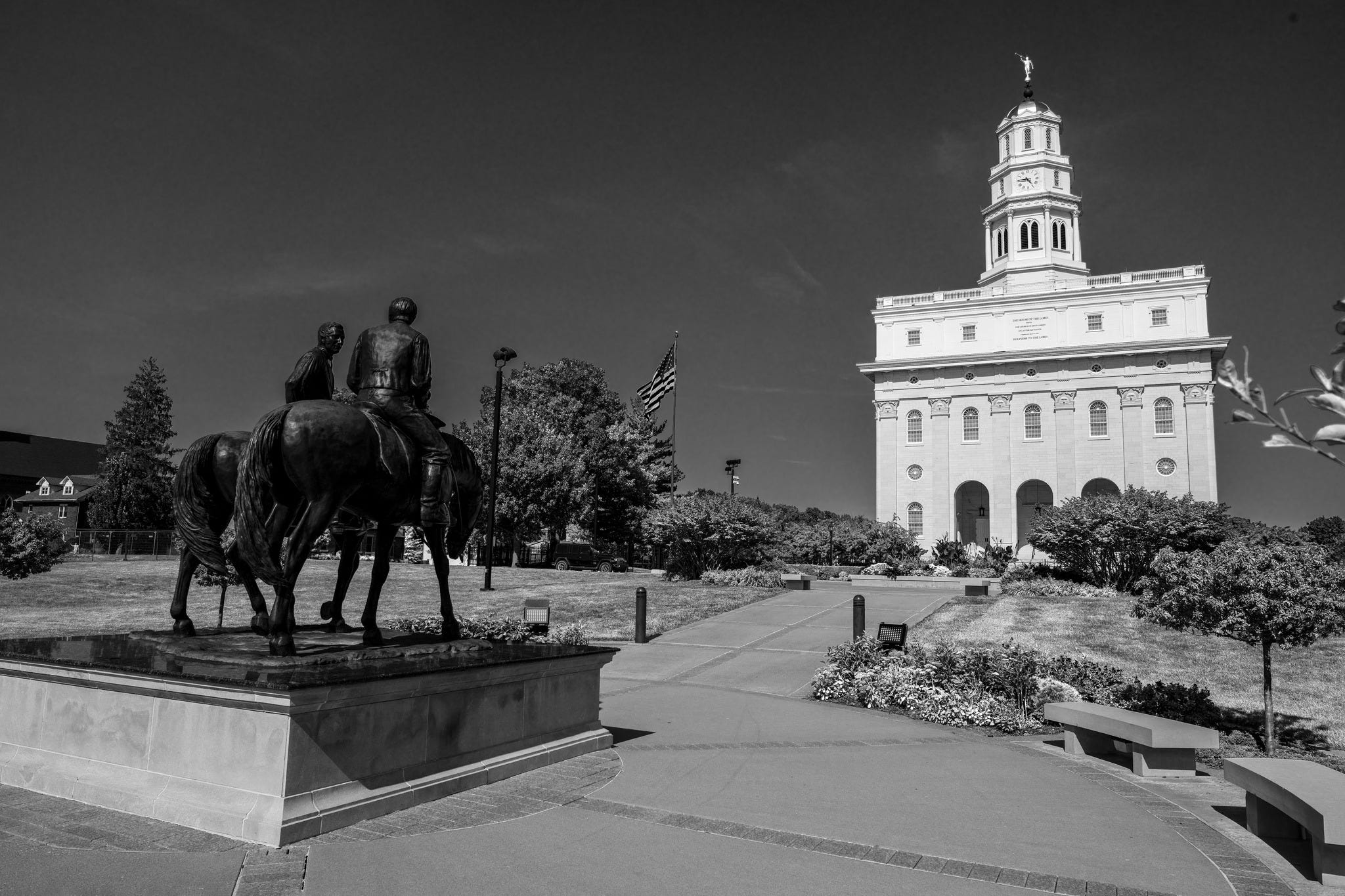
After that the Mormons moved on, though I did see various modern-day pilgrims visiting the temple. They are very easy to spot amongst the otherwise bedraggled folk (me) wandering the depopulated Midwest.
Driving back to the motel, I heard about Trump being shot in Butler PA. I knew then that he would win. In Hancock County, about 75% of the people voted for him. It’s 96% white, mostly not college educated, and around 13% are living below poverty. Biden and Harris had no message that resonated here, and IL would go Dem anyway.
St George Island, FL
It’s called the “Lost Coast.” I stayed in something called the Majestic Jewel Inn, and had Raisin Bran every morning for breakfast. St. George Island has a good deal of beachfront housing on it, very tacky, then it turns into a gorgeous state park. It’s probably only a matter of time before the Lost Coast is found.
Whitfield County, GA
I was driving around with my father-in-law. It was getting near the end for him; he could not remember very much. But we could carry on very good conversations, and he was in a great mood. In Cohutta, GA, my brother-in-law texted, “you better be careful down there.” The town park seemed nice though. After hours of driving, we got a sundae at Baskin Robbins. He passed away not long after.
Crawford County, IL
It looks so inviting, this old camera store and studio… The families that came and got nice pictures… Now cameras are so boring. Damn it.

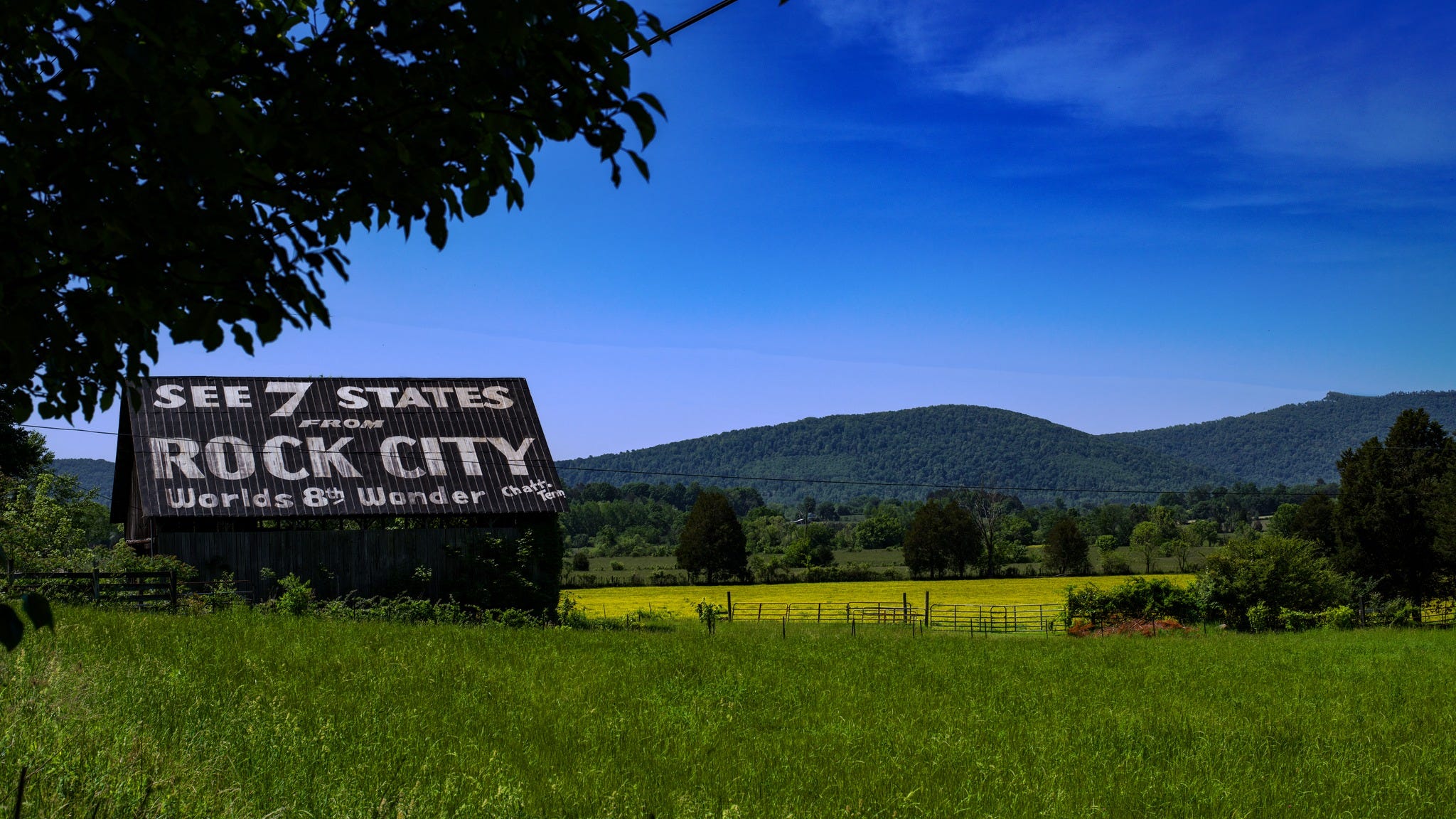
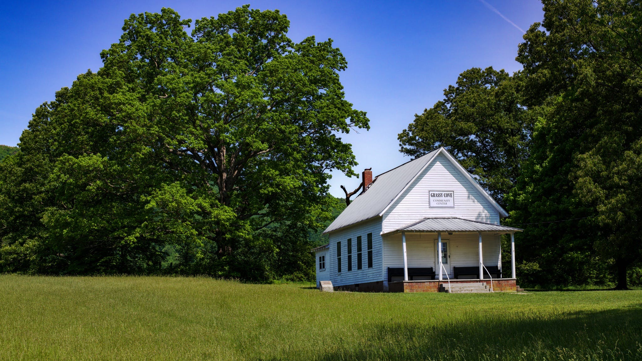
Cumberland County, TN
I don’t know if this photo captures the beauty of Grassy Cove, TN. A See Rock City picture is a must for the automobile photographer. Grassy Cove was living up to its name. It’s a place that you drive down into off of the Cumberland Plateau, where “coves” are sheltered places between the bluffs. It’s actually a huge sinkhole. There’s a single store, which had antiques, junk, some sodas.
Out back there’s a nice “community center.”
That’s enough for now; I have more.